


Brashear Voting District, Adair County, Missouri
About
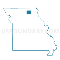
Outline

Summary
| Unique Area Identifier | 606998 |
| Name | Brashear Voting District |
| County | Adair County |
| State | Missouri |
| Area (square miles) | 189.93 |
| Land Area (square miles) | 189.86 |
| Water Area (square miles) | 0.07 |
| % of Land Area | 99.97 |
| % of Water Area | 0.03 |
| Latitude of the Internal Point | 40.18776590 |
| Longtitude of the Internal Point | -92.43033190 |
Maps


Graphs
Select a template below for downloading or customizing gragh for Brashear Voting District, Adair County, Missouri


Neighbors
Neighoring Voting District (by Name) Neighboring Voting District on the Map
- Baring Voting District, Knox County, MO
- Coffey Voting District, Schuyler County, MO
- Greentop Voting District, Schuyler County, MO
- Hurdland Voting District, Knox County, MO
- LaPlata Voting District, Macon County, MO
- Mt. Pleasant Voting District, Scotland County, MO
- Novelty Voting District, Knox County, MO
- Rural Benton Voting District, Adair County, MO
Top 10 Neighboring County Subdivision (by Population) Neighboring County Subdivision on the Map
- Benton township, Adair County, MO (19,700)
- La Plata township, Macon County, MO (1,596)
- Salt River township, Adair County, MO (1,043)
- Pettis township, Adair County, MO (795)
- Salt River township, Schuyler County, MO (728)
- Polk township, Adair County, MO (639)
- Clay township, Adair County, MO (626)
- Richland township, Macon County, MO (607)
- Wilson township, Adair County, MO (503)
- Lyon township, Knox County, MO (484)
Top 10 Neighboring Place (by Population) Neighboring Place on the Map
Top 10 Neighboring Unified School District (by Population) Neighboring Unified School District on the Map
- Kirksville R-III School District, MO (22,063)
- Schuyler County R-I School District, MO (4,565)
- Scotland County R-I School District, MO (4,419)
- Knox County R-I School District, MO (4,095)
- La Plata R-II School District, MO (2,731)
- Adair County R-II School District, MO (1,379)
Top 10 Neighboring State Legislative District Lower Chamber (by Population) Neighboring State Legislative District Lower Chamber on the Map
- State House District 2, MO (35,389)
- State House District 1, MO (33,818)
- State House District 8, MO (33,540)
Top 10 Neighboring State Legislative District Upper Chamber (by Population) Neighboring State Legislative District Upper Chamber on the Map
Top 10 Neighboring 111th Congressional District (by Population) Neighboring 111th Congressional District on the Map
Top 10 Neighboring Census Tract (by Population) Neighboring Census Tract on the Map
- Census Tract 9501, Adair County, MO (3,802)
- Census Tract 9502, Adair County, MO (3,019)
- Census Tract 4801, Scotland County, MO (2,896)
- Census Tract 9602, Macon County, MO (2,719)
- Census Tract 4702, Schuyler County, MO (2,356)
- Census Tract 9601, Macon County, MO (2,341)
- Census Tract 9602, Knox County, MO (2,107)
- Census Tract 4701, Schuyler County, MO (2,075)
- Census Tract 9601, Knox County, MO (2,024)
Top 10 Neighboring 5-Digit ZIP Code Tabulation Area (by Population) Neighboring 5-Digit ZIP Code Tabulation Area on the Map
- 63501, MO (21,532)
- 63549, MO (2,742)
- 63546, MO (1,715)
- 63561, MO (1,206)
- 63533, MO (805)
- 63531, MO (532)
- 63547, MO (459)
- 63540, MO (150)